LanDTM English 6.0

- Categoría: Graphic Editors
- Licencia: Freeware
- Tamaño: 12.48 KB
- Sistema: wNT w2000 wXP
- Idiomas:

The program to do MDTs and longitudinal profiles in AutoCAD or BricsCAD.
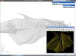
LanDTM is an excellent tool, totally for free, specifically developed for topographers although it could also be useful for mathematicians, architects, surveyors, designers, etc.
From the distinct modules that make up LanDTM you can create MDTs, digital terrain models, add rupture lines, tag them, insert curves, get volume calculations, create longitudinal profiles, etc. It can be used with AutoCAD 2007 or later, and BricsCAD 10.0 or later.
From LanDTM the user can also change edges, insert new lines, delete triangles, insert points, apply colours, calculate volumes, get Delauny triangulations, etc.
DownloadLanDTM English 6.0 related downloads
ACDSee Photo Manager 18
 Download
International versions of this excellent image administrator and viewer, with many supplementary functions.


